

Ever wish you could introduce your students to geospatial information? While there are tools that get the job done, they aren’t always usable by students outside of school. Let’s explore one solution currently in use in K-12 schools with several examples. Then, we will take a quick look at how to get started with a free and open-source (FOSS) option.
The Value of Learning Geospatial Tools
I couldn’t agree with my colleague, Andrew Roush, more when he writes on this topic.
Geographic literacy is a required part of many social studies standards. Using maps can also help learners make visual connections. Those connections can be with abstract thoughts, ideas, and facts that maps represent. Those cognitive links can include maps that address a variety of factors, such as:
- population
- physical landscape
- economic factors
- cultural factors
He makes this point (edited for readability):
The critical thinking that using maps creates can be a help for any teacher at any level and in any subject. Add data to geography to make maps even richer sources of inspiration. What’s more, they heighten understanding and analysis opportunities.
What Do Many Schools Use Now?
ESRI’s ArcGIS is in wide use at many K-12 schools. ESRI has been in K-12 education for many years. In fact, I remember encountering ArcGIS many years ago when a social studies teacher asked how she could get access to it for her students. This longtime presence has given ESRI an edge in connecting with students and staff. No doubt, there are students who learned it in K-12, then started using it when they got into college.
Example 1: Fire and Weather Alert Map
Tami Brass, TCEA member and Director of Instructional Technology at St. Paul Academy and Summit School, shared a Fire and Weather Alert map she created for her students:
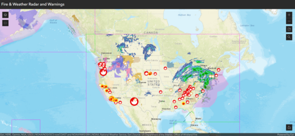
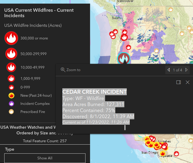
What’s amazing about the online map is you can double-click on the various alert icons (such as a fire icon). This yields more information about alerts issued, as you can see in the screenshot below:
“One of the reasons we decided to implement [ESRI’s ArcGIS] is because it’s the industry standard for most of our state and local governments,” Tami says. She goes on to say, “Schools can set up #arcgis domains with no charge.”
Example 2: 2892 Miles To Go Project
Shana Peeples (Mastodon: @ShannaPeeples) expresses pride in the 2892 Miles to Go project:
Our Route 66 team created a #SocialJustice Story Map. We did this in partnership with National Geographic Education for the #2892 project. We’re really proud of it - https://www.2892walk.org
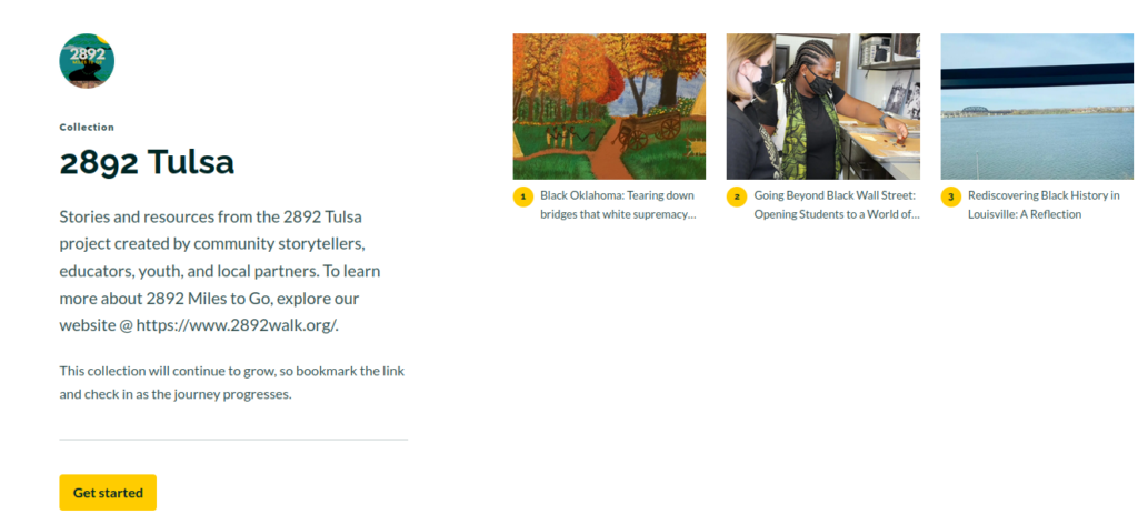
One aspect of the 2892 Miles to Go project is the Tulsa Massacre project:
2892 Tulsa storytellers set out to tell a much more far-reaching and expansive story. The locales include Oklahoma, Tulsa, the Greenwood District, Black Wall Street. They share more about the 1921 Tulsa Race Massacre than what the world has come to learn in the last few years.
This group of academics, historians, activists, and educators want to share a deeper understanding of history. They do this to avoid repeating history. They also do it to advocate for those who are leading the efforts to heal, repair, honor, and rebuild.
It’s powerful work. You can find an educator’s toolkit for 2892 Miles To Go online. It offers suggestions for crafting place-based narratives. With ArcGIS Online Tool, you can create amazing Story Maps.
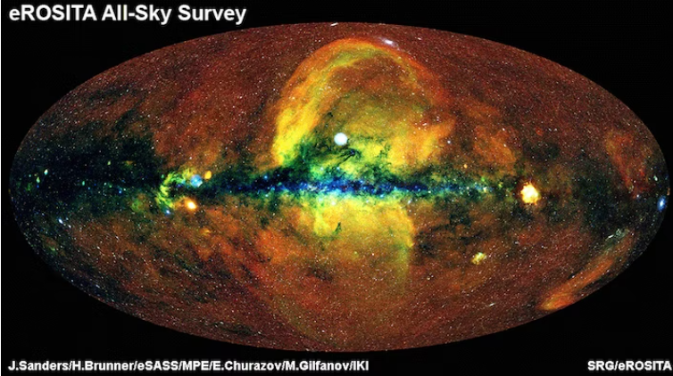
Did You Know?
You can now access a different type of map. The map is a map of the universe. Using a new tool, you can get a 90-degree view of the night sky that has all 13.7 billion years of the cosmos right there in front of them.
Explore the Map
Introducing ArcGIS Story Maps
As you can see from the 2892 project, your students can design “inspiring, immersive stories.” They do this by combining text, interactive maps, and other multimedia content.” The Story Maps website offers great suggestions for getting started, which you can adapt for use with your students.
Learn More about ArcGIS StoryMaps. ArcGIS for Students is available at $100 a year. Free accounts are for K–12 instructional use only. As part of your request, you must agree to the terms of use and meet the following criteria: Based in the US, engage in account management, and have no existing ArcGIS accounts. More on the criteria is available online.
Ready to get started? Follow these steps:
- Create a free, public account with ArcGIS Online
- Visit the Story Maps Apps website
- View the Gallery of Examples
Need someone to introduce GIS to your students? Reach out to Dr. Aida Guhlincozzi. Her work incorporates community geography, among others, and qualitative GIS theory and methodologies. Presentations work with students as young as second grade through high school.
The Challenge
There is a challenge. ArcGIS, the tool Tami and Shanna used to create digital creations, can cost money if students are not in K-12 or in the United States. Students learn the tool when it’s free. This predisposes them to the tool when they get older and have money to spend. That presents a challenge some have chosen to overcome through the use of FOSS.
Choosing Free, Open-Source Alternatives
“I would want to reference the FOSS option, so our students are aware there are alternatives,” asserts Tami. Educator Dave Lane (Mastodon: @lightweight) wouldn’t disagree. He shares a concern with the academic use of proprietary tools. He puts it this way:
Have you ever used QGIS? It’s #FOSS (Free and Open Source Software). It’d be great for your students. That’s because then they could run it at home (if they have a computer) without having to try to find a way to use ArcGIS. Then they can take it as far as their interest carries them.
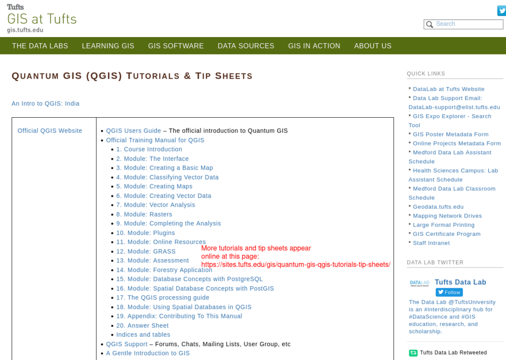
One solution, as Dave points out, is to use QGIS. This is a powerful tool to make available for students to use at home or school. He adds that it is free and open source. Students learn to use a tool that isn’t expensive, and it doesn’t predispose them to closed-source solutions. Free, open-source software often comes with a lot of community-based support, such as tutorials and tip sheets (as shown below).
The Power of FOSS
Dave shares this video that explains the power, as well as the research, behind FOSS:
He explores his journey in a blog entry. It’s worth reading. His concern is that schools may be missing out.
“The amazing thing is that the cost of setting up and using the #FOSS stuff is negligible. We’re supporting 200,000 learners with our digital learning ecosystem. The entire IT infrastructure budget falls under $10k per year. I run it all solo.” (Adapted from Source: Dave Lane)
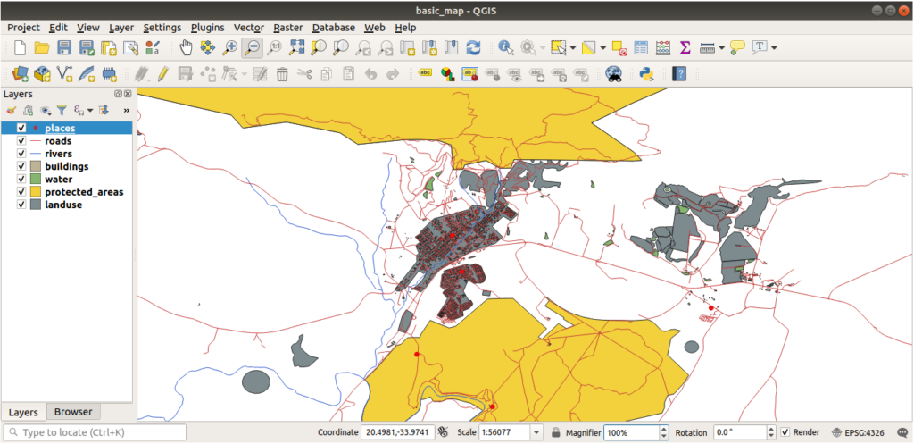
Digging into QGIS
“Yes! It’s [QGIS] a great tool. I’m actually working on a grant to develop a curriculum that would incorporate QGIS,” says Dr. Guhlincozzi. You can get started with QGIS right away since it’s a free download:
Here is a video tutorial on how to use QGIS:
No doubt, some educators may choose to use ArcGIS in Chromebook settings and in K-12. In addition, they may also offer students QGIS as a free, no-cost alternative.
Feature Image Source
Screenshot by author of QGIS software