

This past week, I found myself wondering if making interactive maps with Google Slides and a digital whiteboard might work. All you need for an interactive map is the ability to hyperlink, and Google Slides has that capability. But how to make it more interactive? The answer might lie with a digital whiteboard. In this blog entry, we’ll explore how to create an interactive map you and your students can write or draw on.
Revisiting the Conversation
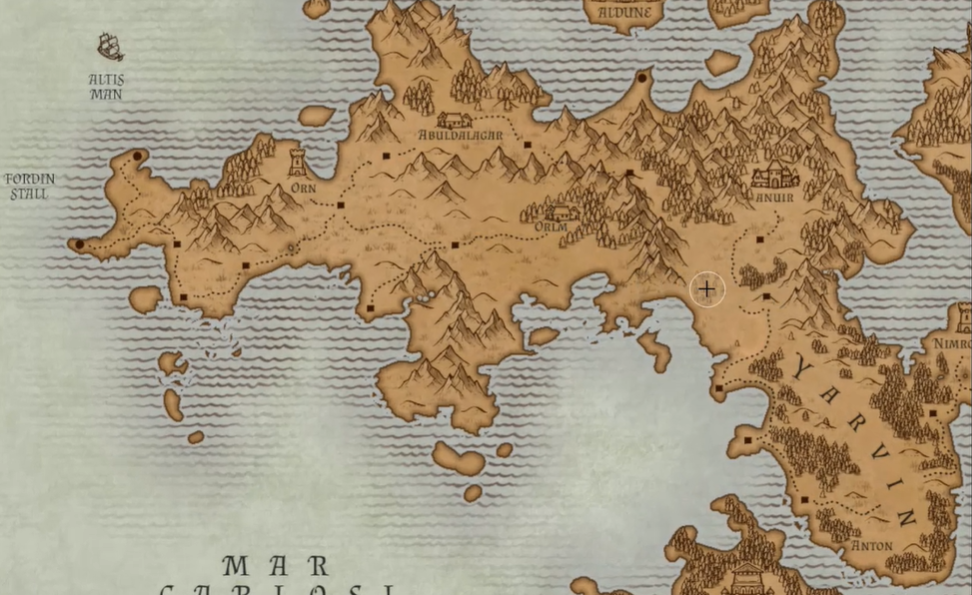
“We’re working on a D and D interactive map,” shared a colleague. I looked at Allison. I had to clarify.
“Are you saying Dungeons and Dragons?” I asked, as a few videos on map-making for novels came to mind. Although I had never played them, role-playing game literature (LITRPG) has been a source of great fantasy stories. I could definitely see how K-12 students, even adult learners, could spend hours engaged in world building, map making, and storytelling. The academic possibilities are endless, from geography to social studies to language learning. Even math could also play a part.
“Yes, Dungeons and Dragons. My husband makes a map for our games. We want to make an interactive one, but aren’t sure how to do it. I wondered if Google Slides might work.”
As you might imagine, it may be possible to create an interactive, clickable map. But Allison went on to explain that they wanted something more: a digital map on which participants could write and circle key areas.
Tools for Making Interactive Maps
Creating digital maps can be a big deal. Online tools like Inkarnate make creating fantasy maps easy to do. It makes battle map, world maps, regional maps, and city and/or village maps easy to make. You can even craft maps inside buildings like taverns, houses, and more. The problem is, you may have to pay for it.
A few other tools you can use include the following (in alpha order):
- Azgaar’s Fantasy Map Generator
- Campaign Cartographer 3: RPG and Fantasy Map Making Software
- DonJon Fractal World Generator
- DungeonFog: Free Role Playing Game Battle Map Editor
- Inkarnate: Create Fantasy Maps Online
- Medieval Fantasy City Generator
Don’t worry, I’ll share some ideas for making maps in Google Slides and a digital whiteboard in a moment. First, let’s take a look at some resources you can explore.
USGS to the Rescue
To get started with maps, I didn’t want to infringe on others’ map creations. As you will see in my example, I looked into online map collections. After a chat with Dr. Aida R. Guhlincozzi, she pointed me to the USGS. So, I dug into the United States Geographical Service (USGS) Topographical Map Collection. What a treasure trove of maps.
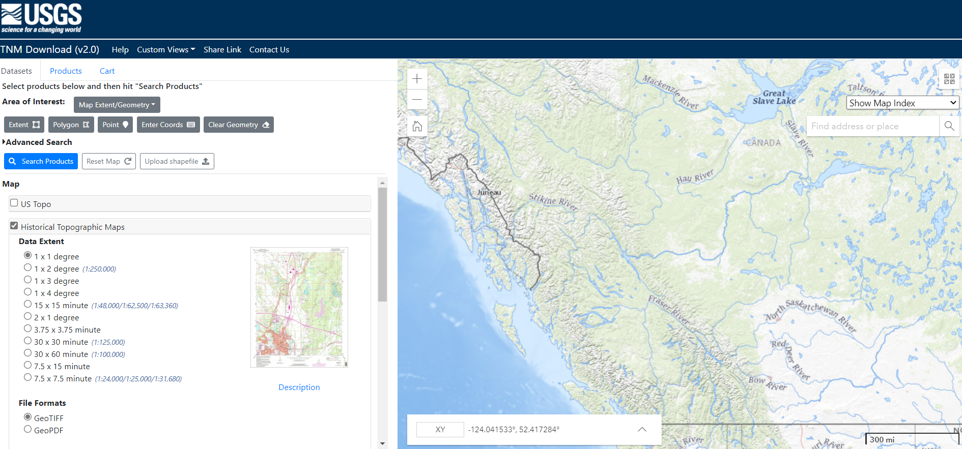
I’ve included the USGS link, among others (e.g. National Geographic), in a curated collection for you. I hope it will save you and your students some time in getting started.
The Digital Cartographer’s Bag of Holding
You’re familiar with a bag of holding, right? It’s a bag with an inside space that may enjoy never-ending storage. You can put anything it and the bag doesn’t get heavier. The internet is a modern traveler’s bag of holding, and Wakelet is one of the ever-expanding compartments.
To get you started in fantasy map making online. I’ve collected a few of the images I found. You will discover a lot more in this magic satchel, The Digital Cartographer’s Bag of Holding. This is a Wakelet collection to get you started.
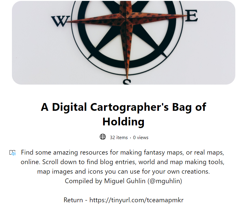
Open the Bag of Holding at https://tinyurl.com/tceamapmkr
Be warned: you can spend hours exploring the contents of this never-ending bag.
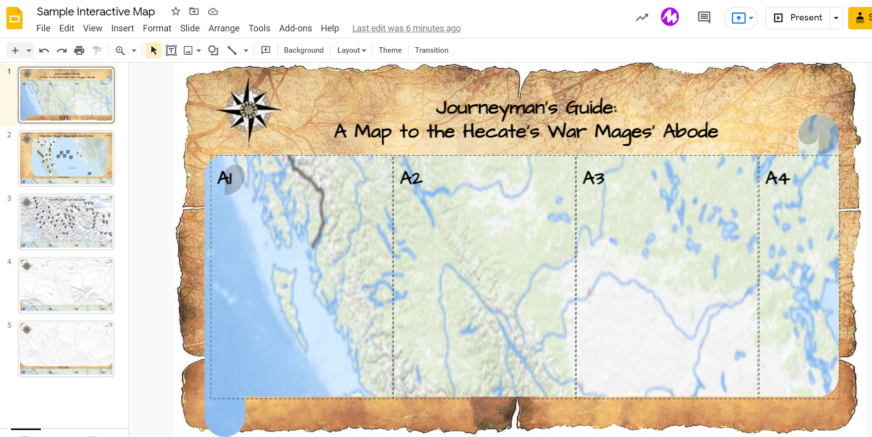
View or Get a Copy of this Google Slides Interactive Map Example
Interactive Maps with Google Slides
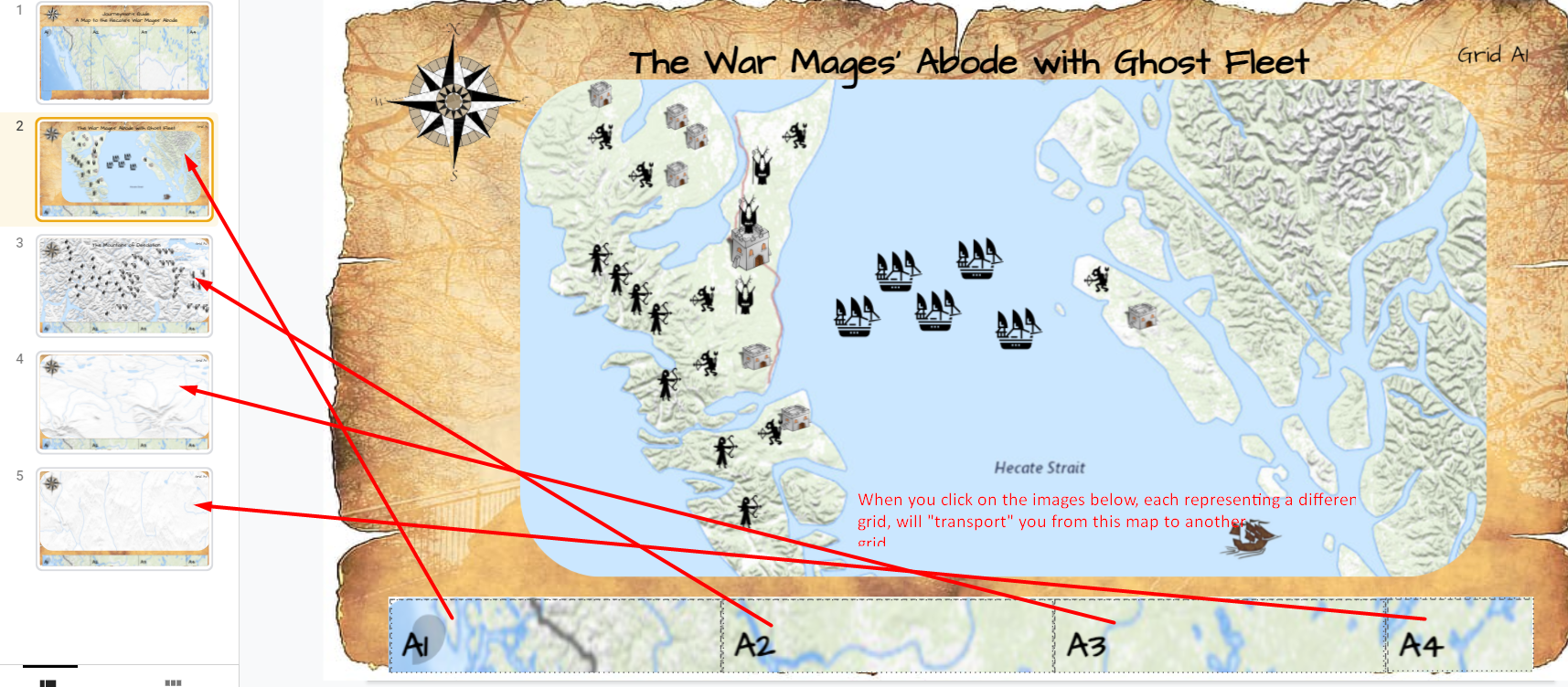
But let’s take map making a step further. To create clickable maps in Google Slides, you need to first arrange the images you want into your Google Slides slide. Then you create subsequent slides. To create a link from one slide to another, INSERT LINK and choose the slide number that you want.
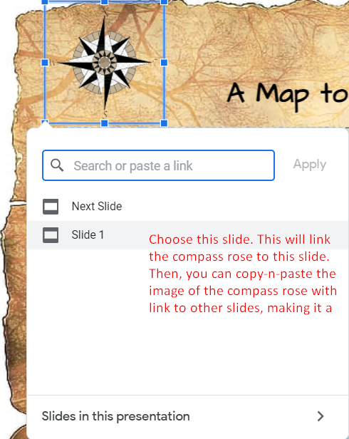
You can even create a menu that will move you from one grid to another, although not necessarily in sequence.
Now, in any situation, you and collaborators may have a need to write on your digital map. How do you do that without messing things up? Not everyone is a Google Slides expert. That’s where a digital whiteboard comes into play.
In this example, the digital whiteboard I’m going to use is Canva’s whiteboard. It makes a snap to import a slide deck, such as from Google Slides, then quickly turn every slide into a whiteboard. Once it’s a whiteboard, it’s interactive. Of course, you can always use another whiteboard solution, such as Figjam. Use what works best for you.
Did You Know?
You can go deeper than you ever thought possible into Google Slides’ capabilities. Sign up now for the online, self-paced TCEA Google Slides course. This course not only covers building a presentation, but also shares how you can leverage the powerful features and functionality of Google Slides for teaching and learning. Participants who successfully complete this course will receive a TCEA Google Slides digital badge and completion certificate, along with 12 CPE hours. Learn more.
Drawing on Your Map with Canva Whiteboard
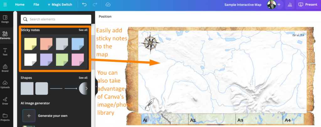
Canva Whiteboard makes it easy for others to interact by adding Post-It-type notes and more to your digital map. You can create an icon that allows people to annotate the map.
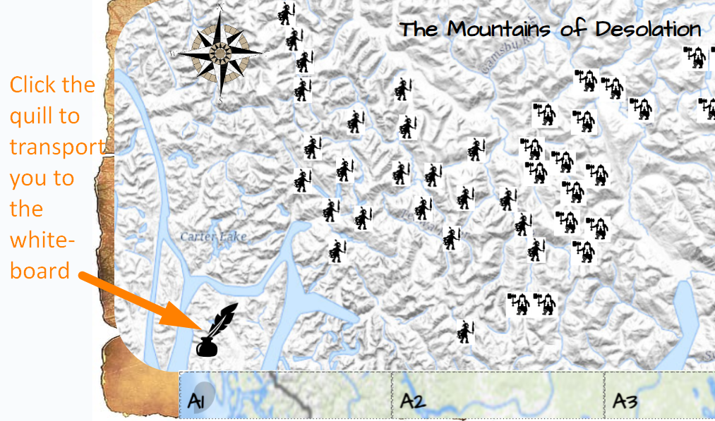
You can see the quill in the map above. Clicking on the quill will “transport” you to a whiteboard that you can write or draw on. With a Canva whiteboard, you may want to make each slide it’s own whiteboard. Or, if you are working with a trusted group of students or individuals, you can let them work on the whole digital interactive map.
Here’s what the whiteboard you can draw on looks like:
View or Get a Copy of This Canva whiteboard
This ensures that I can load any image, such as one from Google Slides that I’ve exported as PNG, as a background that students can add content (e.g. post-its, images/illustrations) to without changing the grid. Isn’t that amazing?
Did You Know?
TCEA has a flexible, online Canva Educator course to introduce you to Canva’s powerful toolkit! Learn how to easily and quickly create spectacular resources, even if you’re not a designer or an artist. Or, if you’re comfortable with Canva’s tools, you may want to jump into TCEA’s Canva Specialist course, which focuses on AI tools and apps.
Creating Interactive Maps
Making interactive maps with Google Slides and/or Canva is quite easy. To be honest, if your district has Canva (it’s free!), you could prepare the slideshow in Canva, then pop out the individual slides as whiteboards (very easy to do in Canva). Or, if you only have Google access, use Slides and some other whiteboard (e.g. Figjam).
You can apply this technique to a variety of instructional activities; it’s not limited to social studies, history, or geography classes. It’s also an easy way to introduce students to map making through role playing games (RPGs). You might find the Dungeon Classroom Guide: Using Table-Top Role-Playing Games in the Classroom worthwhile reading. What’s more, the story writing possibilities that accompany even a simple map are endless. Give it a try!
Feature Image Source
Photo by author.
This blog entry was updated in January, 2024 to reflect the use of Canva whiteboard as a replacement for Jamboard, which Google decided to end in 2024.